
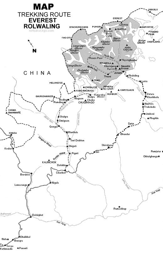
Mapa do Nepal : Região de treing Everest e Rolwaling |
||
| Download: |
|
|
| Tamanho: | 51 Kb | |
| Data de envio: | ||
| Acessos: | 379 | |
|
MOUNT EVEREST(8,850 m)- Sagarmatha as called by Nepali, is the highest peak in the world situated in the north of Solokhumbu district of Nepal.
General Trekking Breakdown EVEREST BASE CAMP-- Flight to Lukla and trek to Phakding- Phakding to Namche Bazzar- Namche Bazzar to Tangboche- Tangboche to Dhingboche- Dhingboche to Lobuche- Lobhuche to Everest base camp- base camp to Lobhuche- Lobhuche to Dhingboche- Dhingboche to Tangboche- Tangboche to Namchebazzar- Namche Bazzar to Khumurung Village- Kamrung Village- Namche Bazzar - Namche Bazzar to Lukla- Lukla to Kathmandu EVEREST BASE CAMP FROM JIRI-- Kathmandu to Jiri By bus- Jiri to Shivalaya- Shivalaya to Bhandar- Bhandar to Sete- Sete to Junbesi- Junbesi Rest Day- Junbesi to Nuntala- Nuntala to Kharikhola- Kharikhola to Puiyan- Puiyan to Phakding- Phakding to Lukla- Lukla to Kathmandu by flight |
||
|
||
Comentários: